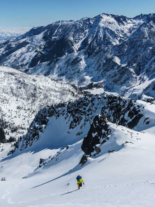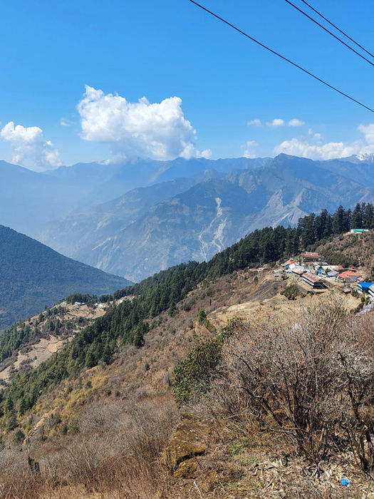
WINTER TREK | ALPINE MEADOWS | PANAROMIC MOUNTAIN PEAKS | ETHNOLOGICAL CHARM
kuari pass TREK
INR 10500
per person
6 Days & 5 Nights
Duration
3,815 m / 12,516 ft
Max. Altitude
21,00 m / 6,900 ft
Min. Altitude
26 Km
Walking distance

WINTER TREK | ALPINE MEADOWS | PANAROMIC MOUNTAIN PEAKS | ETHNOLOGICAL CHARM
kuari pass TREK
In the profound embrace of the Garhwal Himalayas, where the sacred and the sublime intertwine, lies a passage both ancient and eternal: Kuari Pass, also reverently known as the Lord Curzon Trail. Kuari Pass is not simply climbed or traversed. It is entered with reverence, as one steps across the threshold where altitude becomes a metaphor for ascent within; where the sky’s infinite canvas reflects the mind’s boundless capacity for wonder and introspection. These peaks, Nanda Devi, the fierce yet nurturing queen of the Garhwal, Chaukhamba’s majestic domes, the stoic Kamet, and the triple-pronged Trishul, stand as silent witnesses to eons of geological upheaval and human devotion.
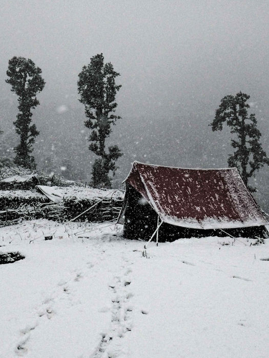
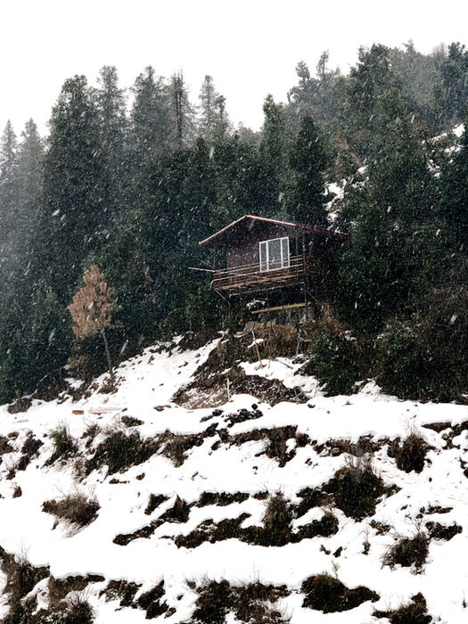
Rising to an altitude between approximately 12,500 and 12,516 feet (3,800 to 3,815 meters), Kuari Pass offers a vantage that is both a literal and symbolic pinnacle. The ascent is a gradual peeling away of layers, of vegetation, temperature, and distraction, until one stands at a place where the horizon expands into endless possibility and where the sacred geometry of nature is laid bare: snowfields that shimmer like fractured light, meadows that hum with the pulse of the earth, and forests that rain color as seasons turn their eternal wheel.The trek itself, covering 26 to 30 kilometres, is a dialogue between the walker and the mountain. As winter descends, Kuari Pass transforms into a crystalline realm of silence and stillness. Snow blankets the path and meadows, muffling the forest’s breath and rendering the landscape ethereal, both beautiful and unforgiving. This season demands a different kind of reverence and resilience, inviting only the well-prepared and the deeply committed to witness the Himalayas in their most pristine, raw form.
Yet, what elevates Kuari Pass beyond the sum of its physical challenges is its intricate layering of cultural, ecological, and spiritual narratives. The trail meanders through villages where the rhythms of life still echo ancient traditions, and where the forest canopy shelters not just flora and fauna but centuries of stories and rituals. It is a realm where seasons sing their own song: the lush bursts of spring’s rhododendrons, the crisp clarity of autumn light, the silent majesty of winter’s snow, and the fertile embrace of summer’s rains.
Summary
The journey begins from Joshimath (6,070 ft / 1,850 m), a gateway town in the Garhwal Himalayas. From here, the motorable road gently climbs through pine and rhododendron forests, winding along streams and terraced fields, and leads to Tugashi (7,050 ft / 2,150 m), a quaint village from where trekkers starts their hike amidst serene surroundings.
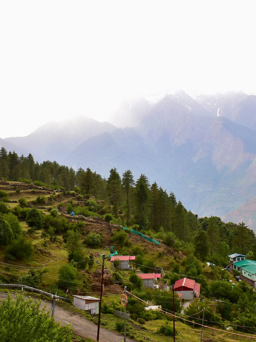
As the trek continues, the trail ascends further into lush meadows at Guling (8,530 ft / 2,600 m), offering panoramic views of snow-capped peaks like Nanda Devi, Dronagiri, and Kamet. The route then passes through Khullara Camp (10,170 ft / 3,100 m), a perfect spot to rest, acclimatize, and enjoy the peaceful Himalayan landscape.
The real highlight is the climb to Kuari Pass (12,139 ft / 3,700 m), where trekkers are rewarded with sweeping vistas of some of the highest peaks in the Garhwal region. On clear days, the horizon is dotted with the entire Nanda Devi group, Hathi Ghoda, Chaukhamba, and Nilkanth, making it a spectacular destination for photography and nature lovers.
The trek covers around 35 km round trip, with moderate gradients suitable for beginners and intermediate trekkers. Along the way, trekkers experience a mix of dense forests, open meadows, cascading streams, and tranquil villages, offering both adventure and cultural immersion in the heart of the Himalayas.
FEATURED
Panoramic Himalayan Scenery: From Kuari Pass summit, sweeping views of towering giants like Nanda Devi, Chaukhamba, Kamet, and Trishul, peaks that hold both geological and mythic weight.
Cultural & Historical Echoes: Base towns like Joshimath, Karchon, Karchi, and villages along the way; the trail known historically (e.g. Lord Curzon’s travels); the interplay of local life and pilgrimage in the valleys.
All‑Season Variation: Depending on time of year, snow drapes higher trails; spring brings blossoms; post‑monsoon the meadows are green; winter offers crystalline silence
Diverse Forest Zones: Lower slopes rich with oak, rhododendron, deodar, walnut; flowering under canopies; the transition from dense cover to open meadow reminds you of nature’s gradation.
MEALS INCLUDED
Breakfast : 5
Lunch : 4
Dinner : 5
TRAVELING STAFF
Guide
Cook
Muleteer
TRANSPORT
Mini bus/Traveller
ACCOMODATION
3 nights of camping
DEGREE OF WALKING
Moderate
GROUP SIZE
Up to 10 people
Dehradun/Hrishikesh to Joshimath
You rise before dawn, leaving behind the sacred confluences where rivers whisper their ancient tales, Devprayag, Rudraprayag, Karnaprayag, each a hymn to the meeting of water and stone, faith and earth. The winding road begins its steady climb, carrying you upward through shifting light and cooling air, a slow unraveling of the world below. Over the course of approximately 280 kilometers, the journey unfolds through valleys stitched with pine and cedar, past ancient temples and mountain hamlets that breathe stories of time and tradition. Elevation climbs gently yet surely, from the foothills' warmth to the crisp breath of altitude, as you ascend from near 400 meters to the mountain town of Joshimath, perched between 1,900 and 2,000 meters (6,150 - 6,500 feet).
By evening, the bustling hum of the plains fades, replaced by the quiet pulse of highland life. Here, the scent of pine mingles with the cool mountain air, and the peaks stand sentinel, waiting. Rest well, for tomorrow you step beyond roads and into the wild embrace of the Himalayas
Meals
DINNER
Difficulty level
EASY
Distance
280 KM
Traveling time
7 TO 8 HOURS
Maximum height
2000 M / 6500 FT
Tavel Mode
Bus/ traveller
DAY
1
Tugashi Village to Gulling
The morning begins with a short, winding drive from Joshimath to Tugashi, a village perched at roughly 6,900 feet (2,100 meters), where the stone paths and terraced fields whisper the last remnants of human habitation. From here, your real ascent begins.
The trail winds upward for approximately 6 kilometers, gaining nearly 2,000 feet in elevation over the course of 4 to 5 hours. The first stretch carries you through sun-drenched ridges and scattered shepherd huts, but soon the terrain shifts, slate paths give way to soft earth, and the canopy of oak and rhododendron gathers above like a cathedral of green. The climb is gentle but constant, a quiet invitation to slow your pace and deepen your breath. As you ascend, the temperature cools and the forest deepens. The noise of roads and routines falls away behind you, replaced by birdsong, leaf-fall, and the rhythmic pulse of your footsteps.
By late afternoon, you reach Gulling Top at approximately 9,600 feet (2,925 meters), a serene forest clearing dappled in light and ringed by trees that seem to lean in, listening. Tents rise like quiet sanctuaries under the sky. As the air cools and the stars begin to appear, you realize: the journey has begun not just through landscape, but through layers of self.
Meals
BREAKFAST, LUNCH & DINNER
Difficulty level
EASY
Distance
6 KM
Traveling time
4 TO 5 HOURS
Maximum height
2925 M / 9600 FT
Tavel Mode
HIKE
DAY
2
Gulling to Khullara
You rise with the trees, their dark silhouettes standing guard over the quiet valley. Morning light filters through mist, and the forest stirs to life, slow, reverent, and alive with possibility. From Gulling Top ( 9,600 ft / 2,925 m), the trail calls you higher into the realm where earth begins to loosen its hold and the sky expands with every step.
Today’s trek is about 4.5 to 5 kilometers, with a steady altitude gain of 1,100 to 1,300 feet. The gradient is not harsh, but persistent, a patient pull upward through increasingly open forest. The dense canopy of oaks and rhododendrons begins to thin. You begin to notice the sky more often, fragments of blue opening between branches, hints of snow-capped horizons appearing like distant promises.
With every turn, the landscape becomes more austere and spacious. In spring, rhododendrons may still burn crimson and pink along the slopes, a seasonal fire lingering in the cool air. In late autumn or winter, snow may already be dusting the edges of the trail, and your breath will carry the weight of frost and silence. You arrive by early afternoon at Khullara ( 10,800 ft / 3,292 m), a windswept alpine clearing that feels exposed yet deeply rooted. The surrounding ridgelines rise like waves frozen in motion. Peaks begin to reveal themselves, glimpses of Nanda Devi, Dronagiri, and Hathi Ghoda, their presence quiet but overwhelming.
Here, you rest beneath a vast Himalayan sky, one foot still in the forest, the other on the edge of the alpine world. You are not yet at the pass. but you are well within the domain of the mountains. Tonight, the stars will feel impossibly close. Tomorrow, you will climb into them.
Meals
BREAKFAST, LUNCH & DINNER
Difficulty level
EASY TO MODERATE
Distance
5 KM
Traveling time
4 to 5 HOURS
Maximum height
3292 M / 10800 FT
Tavel Mode
HIKE
DAY
3
Khullara to Kuari Pass and descent to Tali
The day begins before the sun, under a sky pale with anticipation. There is a hush in the air at Khullara (10,800 ft / 3,292 m), as if even the forest is holding its breath. Today, you ascend to the heart of this pilgrimage: Kuari Pass, perched at 12,516 feet (3,815 meters). The climb is both physical and philosophical.
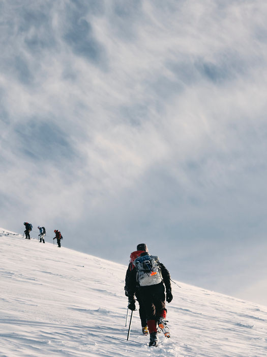
The trail stretches 6 to 7 kilometers round-trip, with an altitude gain of roughly 1,700 feet. The path rises steadily, curling around steep ridgelines and open alpine slopes. Trees give way to grass, grass to snow (depending on the season), and the wind sharpens into something ancient, something that carries the memory of glaciers and gods. As you rise, the world changes shape. Peaks begin to appear not just as distant silhouettes, but as sovereign presences: Nanda Devi, quiet and monolithic; Dronagiri, fierce in her angles; Chaukhamba, Kamet, Neelkanth, and Hathi-Ghoda standing like sentinels of forgotten myth. In winter, the snowfield that leads to the pass becomes a white canvas upon which each step feels both daring and devotional.
Reaching Kuari Pass is not a dramatic arrival but a revelation. There is no summit marker, no flag, only silence and an unbroken sweep of Himalayan grandeur. It is here, in the presence of sky and snow, that something opens: a stillness, a clarity, a long exhale. You realize you have not conquered anything. Instead, you have been allowed a glimpse, brief, unspeakable, into something far larger than yourself.
After time spent in quiet awe, you descend, either retracing your steps back to Khullara or continuing onward to Tali campsite (11,070 ft / 3,374 m), depending on weather and route. The descent is lighter, not just on your legs but in your heart. You walk differently now, quieter, perhaps more aware of the rhythm of the wind, the crunch of earth beneath your boots, the breath of the mountain in your chest.
Night falls around the tents like a soft ritual. The stars above the pass seem closer now, as if they remember you. And maybe they do.
Meals
BREAKFAST, LUNCH & DINNER
Difficulty level
MODERATE
Distance
7 KM
Traveling time
6 TO 7 HOURS
Maximum height
3815 M / 12516FT
Tavel Mode
HIKE
DAY
4
Tali to Joshimath via Gorson Bugiyal (Auli)
The morning begins not with anticipation, but with something gentler: stillness. You wake beneath a sky that now feels familiar, its vastness no longer daunting, but intimate. Whether you begin from Khullara or the slightly higher Tali campsite (11,070 ft / 3,374 m), the trail now begins its long, slow descent back toward the world you left behind.
You will walk approximately 11–12 kilometers today, descending nearly 3,500 to 4,000 feet, through a landscape that unfolds in reverse, but not quite as it was. The forest, once a passage into the unknown, now feels like an old companion. The same ridgelines, the same bends in the trail, the same trees now speak a different language, because you are no longer the same.
As you descend toward Auli, famed for its winter slopes and wide, curving panoramas, the full Himalayan arc reveals itself one last time: Nanda Devi, Hathi-Ghoda, and the high Garhwal ranges linger like a memory on the verge of fading. The trail here is more open, more sculpted by wind and sky. You pass through oak forests, alpine grasslands, and finally, meadows that lead into civilization.
At Auli, a vehicle awaits to carry you down the winding road back to Joshimath (6,150–6,500 ft / 1,900–2,000 m). As the elevation drops, so does the volume of the wilderness. The voices of the city return gradually, motor horns, chatter, signs of return. Yet the silence remains within you, folded neatly like a letter from the mountains. By evening, you are back in Joshimath
Meals
BREAKFAST, LUNCH & DINNER
Difficulty level
EASY TO MODERATE
Distance
11 KM
Traveling time
6 TO 7 HOURS
Maximum height
3374 M / 11070 FT
Tavel Mode
HIKE
DAY
5
Joshimath to Dehradun/Rishikesh
You wake in Joshimath, no longer at the edge of the forest, but back within the pulse of human life, rooftops, chai stalls, cables swaying in the morning breeze. Today, you journey back to Rishikesh or Dehradun, retracing the winding mountain roads over 8 to 10 hours and covering nearly 260 kilometers, but this time, the road carries more than your body. It carries memory.
You pass once again through the confluences, Karnaprayag, Rudraprayag, Devprayag, each now reframed not as geographical landmarks, but as mythic signposts along a personal mythology. The rivers rush on, indifferent and eternal. The hills, too, return to their slow watching.
And yet, something in you has been re-aligned.This is the paradox of the mountains: you come seeking height, and leave with depth. You arrive in Rishikesh or Dehradun by evening, where the roads are busy and the world moves quickly, but you move differently now, steadier, as though the trail still echoes quietly beneath your feet.
Meals
BREAKFAST
Difficulty level
EASY
Distance
280 KM
Traveling time
10 TO 11 HOURS
Maximum height
2000 M / 6500 FT
Bus
TRANSPORT
DAY
6

The best hiking trails in India
Our curated collection of India’s most remarkable hiking trails invites you to connect intimately with the country’s natural wonders. From the snow-draped peaks of the Himalayas to mystical glacial lakes, cascading waterfalls, and shimmering glaciers, each journey offers a profound encounter with the sublime. Traverse landscapes teeming with diverse wildlife, where every step unfolds a story of nature’s grandeur, and immerse yourself in adventures that linger long in memory, a perfect harmony of challenge, discovery, and the timeless beauty of the outdoors.

CHamoli - Uttarakhand
Kuari Pass
6D/5N
₹ 12500

CHAMOLI - UTTaRAKHAND
Bagini Glacier
5D/4N
₹ 10500

UTTARKHASHI - UTTRAKHAND
Ghamshali Bugiyal
6D/5N
₹ 9500

Joshimath- UTTRAKHAND
Dyalishera
4D/3N
₹ 11000

AULI - UTTRAKHAND
Tungnath Chopta
4D/3N
₹ 11000

AULI - UTTRAKHAND
Tungnath Chopta
4D/3N
₹ 11000

AULI - UTTRAKHAND
Tungnath Chopta
4D/3N
₹ 11000

We are here to help
Whether you have a single question or a special request, we're here to help.

Kartik

Prajokta

Bhagat
OUR DEDICATED TEAM OF TRAVEL EXPERTS IS HERE TO HELP YOU !
+ 91 7351521027, + 91-8218621366
OR
WRITE US DIRECTLY AT


